3D rendering service
Architectural Photomontage for Planning and Marketing
Standard planning renders from A$445 · photomontage and verified views quoted per project · up to 4 revision rounds
Architectural photomontage puts a 3D model of a proposed building into a photograph of the real site. The street, the trees and the neighbouring houses are real. Only the proposal is computer-generated. That is why a council officer, a neighbour or a tribunal member reads a photomontage differently from a fully rendered image: the context is the real context. We produce planning photomontage and verified views from your drawings and your site photographs, or from photography and survey data supplied by a local operator we arrange.
This page covers the service: what we make, what we need from you, how the match is checked and how the work is priced. What councils and panels expect in each state is covered in our guide to renders for development applications, and it is worth reading before you decide how many viewpoints the application needs.
- Starting price
- A$445 per standard planning render
- Turnaround
- 5–7 business days (rush 48–72 hours)
- Revisions
- Up to 4 rounds included
- You send
- Plans, elevations, sections and a finishes schedule
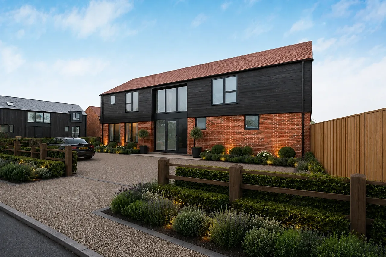
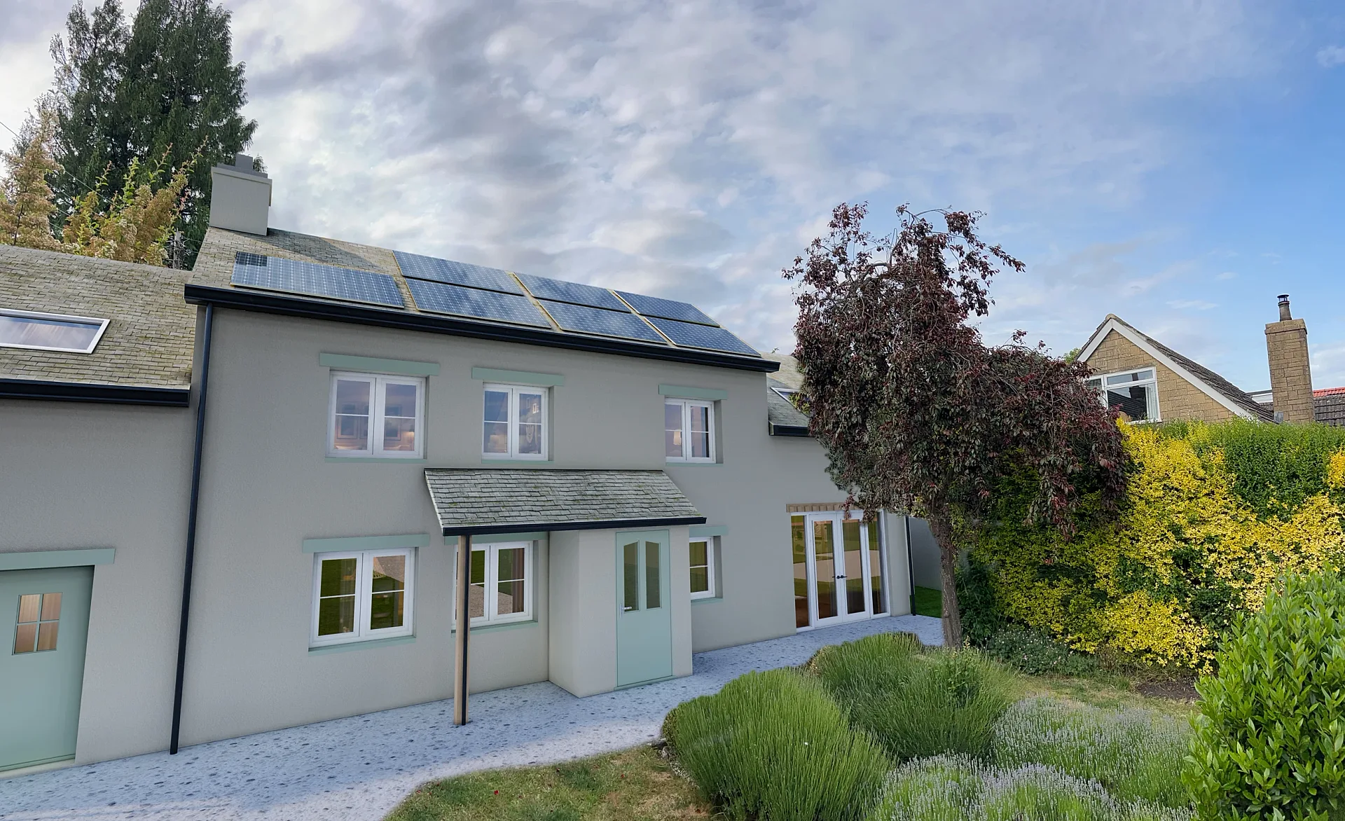
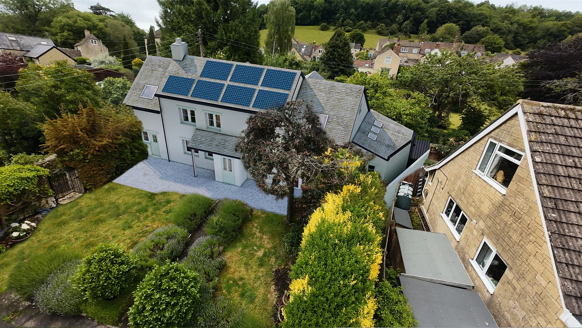
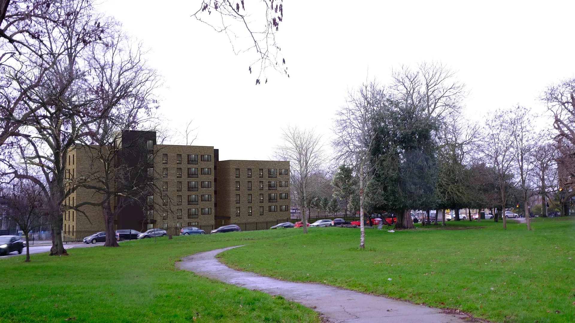
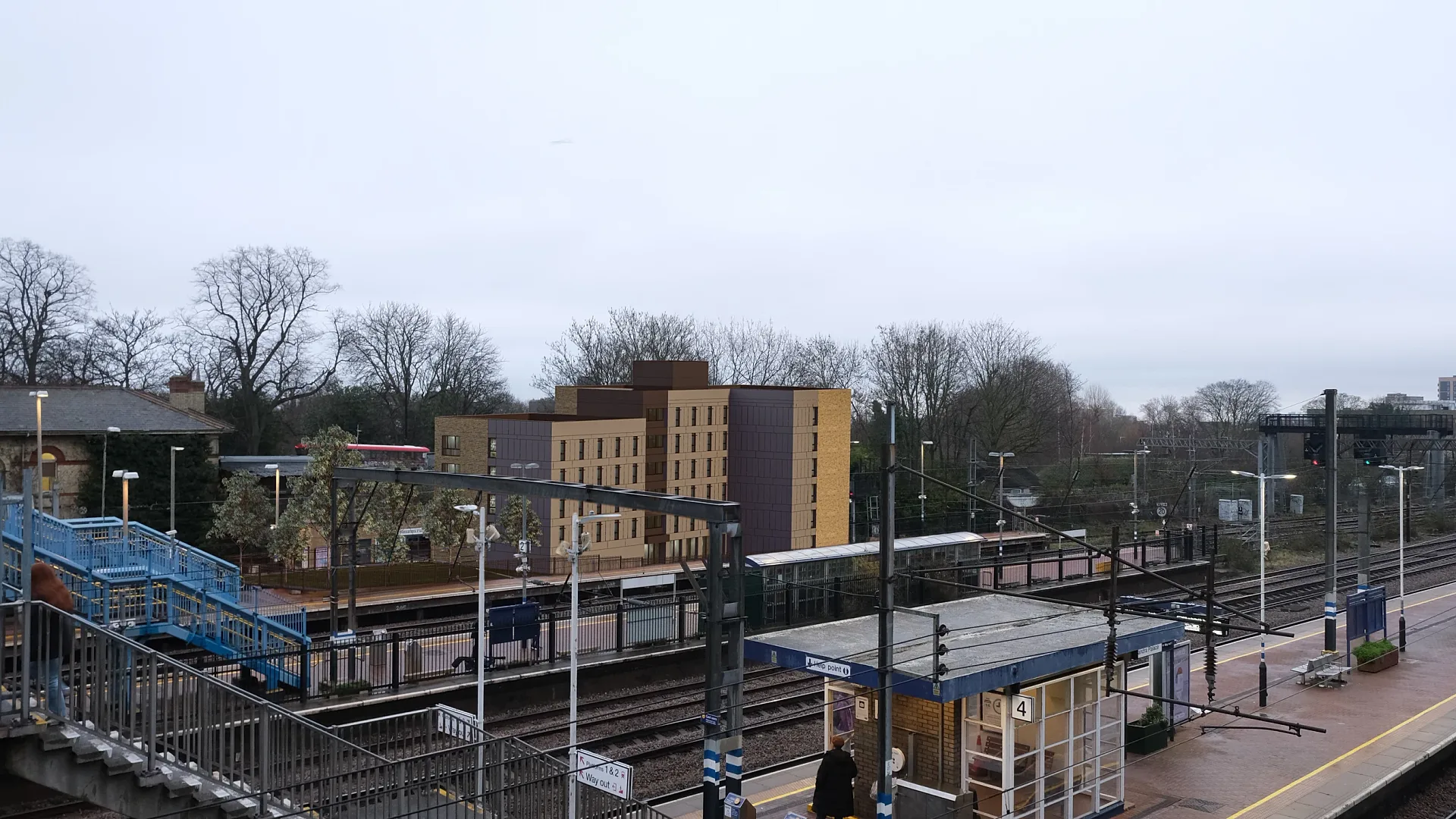
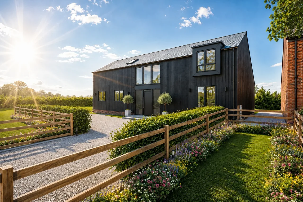
Architectural photomontage: what we produce
Every view starts from one photograph and one decision about where the camera stood. We build the proposal in 3D from your plans, elevations and sections, then set a virtual camera to the real camera's position, height, direction and lens. The building is rendered under light that agrees with the photograph and composited in.
The step that separates a believable montage from a building pasted onto a sky is masking. Anything that stands between the camera and the new building in real life, such as a tree trunk, a power pole, a street sign or a parked ute, is cut out and placed back over the top, so the proposal sits behind it. Where a street tree would partly screen the building, the image shows the building partly screened. A montage that quietly deletes the obstruction is the one a reviewer distrusts.
The number of views depends on where the proposal will be seen from, not on a standard package. A single dwelling may need one view from the footpath. A larger building usually needs the public viewpoints that matter: the street frontage, the intersection down the road, a neighbour's rear boundary, the park opposite. Agree that list with your town planner before photography starts, because a viewpoint added late means another site photograph.
Planning photomontage or verified view
Both are camera-matched photomontages. The difference is how much evidence sits behind the image, and therefore how much it costs and how long it takes.
Planning photomontage
A planning photomontage is matched carefully to the photograph and checked against the drawings, but the camera position is recorded from the photographer's notes and tied to known points rather than documented to verified-view standard. It suits single-dwelling and small-scale applications, pre-lodgement meetings, consultation boards and any case where the council wants to see the proposal in context and the geometry is not expected to be contested.
If you only need a street view with the context built in 3D and no photograph, a standard planning render is the simpler option, from A$445 per image.
Verified view
A verified view adds a surveyed camera position, a wireframe overlay and a written method statement, so an independent party can repeat the check. The guide to renders for development applications explains what each element is and where it is expected.
Choose verified views where height or bulk is the contested point: a building on a ridge, beside a heritage item, above a neighbour's courtyard, or heading to a panel or tribunal. If you are unsure which tier the assessment needs, ask the council or your planner, then tell us and we quote to suit.
What we need for camera matching
We work remotely, so the inputs decide the accuracy. They come from you, from your surveyor, or from a local photographer or drone operator we arrange for the site. We do not visit the site ourselves.
- Drawings as lodged or near final: plans, elevations, sections and the materials schedule, as DWG, PDF, Revit, ArchiCAD or SketchUp files.
- The original photograph files, not screenshots or cropped copies, with their metadata intact.
- For each photograph, the camera model, the focal length, the camera height and where it stood marked on a site plan. A tripod and a level camera make the match far more reliable.
- Survey data for the site and its neighbours: levels, boundaries, and the heights of adjoining buildings and trees that sit near the view.
- For a verified view, a surveyed position and level for each camera station.
- For a drone view, the aircraft's recorded position, height and camera settings.
How the match is checked
Before a montage goes to you we check that fixed features in the photograph, such as the road edge, a fence line or a neighbouring roofline, line up with the same features in the survey model. We also confirm that the building's own height and setbacks in the image agree with the lodged drawings, because a late design change that never reached the model is how an image ends up contradicting the application. Finally, we compare the light on the new building with the light in the photograph, including shadow direction and sky colour.
For verified views the first test becomes a visible deliverable: the wireframe overlay is supplied alongside the finished image, and the method statement lists the inputs it used, including who supplied the photograph and the survey data. Where a dimension has been estimated because survey was not available, the statement says so. Flagged limitations are easier to defend than discovered ones.
You see a draft before finals, with materials and lighting close to final, and revisions come from your mark-ups, with up to 4 rounds included. We do not send grey camera previews.
Where a photomontage is used
Planning photomontage is the main use, but the same method serves other jobs once the model and the matched photographs exist.
Development applications and pre-lodgement
A planner meeting a proposal for the first time wants to know what a resident would see from the street. Our Pre-Lodgement Street Views and Aerial project was four camera-matched street views composited into the client's own photographs, plus a high-level context view built from mapping imagery because no site photograph existed for it. Our Two-Storey Extension Planning Renders project placed an extension into the owner's photographs and drone shots, with a fifth view added after the planning consultant revised the rear roof.
Objections, consultation and tribunal matters
When an application draws submissions, a photomontage lets neighbours and decision-makers argue about the same picture. It can also show a revised scheme against the original. A render illustrates a design. It does not prove compliance with a planning control, and whether an image is relied on in evidence is a matter for your expert and your lawyer, not for us.
Marketing hoardings and site signage
A montage on a site hoarding, with the building standing in its actual street, tells passers-by what is coming. It can be drawn from the same photographs as the planning views, though a marketing version may use better light and a more flattering sky, and we keep the two versions separate so the application image stays neutral.
Landscape and lot sales
Where houses are built but the lot is still mud and stacked materials, the montage works the other way round: the real building stays, and the finished landscape is added. Our Landscape Photomontage for Lot Sales project took photographs of completed new-build homes, removed site clutter and added lawns, planting, fencing and gravel drives so each lot could be marketed as finished. For a whole release rather than one lot, our 3D aerial rendering page covers the overview.
How photomontage is quoted
Photomontage and verified views are quoted per project, and we say so plainly because the price depends on inputs that differ with every site. A fully rendered planning view starts from A$445 per image. A montage is quoted separately, and the price depends on the points below.
- The number of viewpoints, and whether each is a planning photomontage or a verified view.
- Who arranges the photography and survey: you and your surveyor, or a local operator we arrange.
- How much masking each photograph needs. A clear frontage is quick. Dense street trees in front of the building are not.
- Whether a model already exists or has to be built from drawings.
- The number of design options or staging scenarios shown for each viewpoint.
- Whether a drone view or an aerial photomontage is included.
Timing and how to start
Once the drawings, photographs and survey data are in hand, modelling and rendering follow the usual 5–7 business days from an approved brief. Photography and survey come first and add lead time that depends on who is arranging them, so ask us for a schedule when you brief and fix those dates early.
To get a quote, send the drawings, the site address, the list of viewpoints you have in mind and any photographs you already hold. Say whether the images go to council, to a panel or into marketing. We reply with what is missing, which tier we recommend for each view and a fixed quote. The briefing guide covers the general checklist for any render.
Proof
Architectural Photomontage projects from the portfolio
How it works
How we produce architectural photomontage
- 01
Send your drawings
Plans, elevations and sections in PDF, DWG, SketchUp, Revit or ArchiCAD — or a marked-up sketch. Add material schedules, finishes and any reference photos you like.
- 02
Fixed quote in one business day
You get a per-image price in AUD, the delivery date and what's included. No hourly billing and no surprises at invoice time.
- 03
Draft render for your feedback
Within 3–4 days you receive a draft render with materials and lighting close to what you need — the angles, finishes and mood all visible — so feedback is about real images, not diagrams.
- 04
Revisions from your mark-ups
You mark up the draft and we work through the changes. Up to 4 revision rounds are included.
- 05
Final delivery
High-resolution files (4K–8K TIFF/JPEG/PNG) sized for print and web, typically in 5–7 business days from brief. Rush delivery available in 48–72 hours (rush surcharge applies).
Questions
Architectural Photomontage: frequently asked questions
A 3D model of a proposed building composited into a real photograph of its site. The street, trees and neighbours are the real ones, and only the new building is computer-generated. It is camera-matched, so the building sits at the right scale and position, and masked, so real foreground objects stay in front of it.
Both are camera-matched. A verified view adds a surveyed camera position and level, camera and lens on record, a wireframe overlay of surveyed features on the photograph and a written method statement. It carries more evidence and takes more fieldwork, and it is quoted per project.
No. We work remotely. Photographs come from you, your surveyor, or a local photographer or drone operator we arrange. Tell us before anyone photographs the site, and we say which viewpoints and what camera data to record so the match works.
It is quoted per project, because photography and survey inputs vary. A standard fully rendered planning view starts from A$445 per image, and a montage is quoted separately according to viewpoints, masking, survey and options. Send the drawings and the list of views for a fixed quote.
That depends on the council and the site, so check with the council or your planner. A single dwelling may be well served by one street view. A larger building usually needs the public viewpoints it is seen from. We can propose a list once we have the drawings and site plan.
Only as a guide to choosing viewpoints. Street imagery rarely records the lens, height or position needed to match a camera, and its image quality is low for a printed submission. A photograph taken for the purpose gives a far better result.
Yes. We clear site clutter, then add lawns, planting, fencing and drives to a virtual camera matched to your photograph, with sun direction and shadows following the original. It suits lots that are built but not yet landscaped. Quoted per project from your photographs.
We cannot promise how any council or tribunal will treat an image. Requirements vary, and a render illustrates a design without demonstrating compliance. Ask the council or your planner what the assessment will turn on, and we prepare the views to suit.
Where we work
Architectural Photomontage across Australia
Same published prices in every city, with local planning context and building products.
Architectural Photomontage is one part of our architectural visualisation work, which also covers planning renders and verified views for councils and tribunals.
- Melbourne projects
- Sydney projects
New South Wales
3D rendering Sydney
Parramatta, Green Square, Zetland, Rhodes, Macquarie Park and across NSW.
- Brisbane projects
Queensland
3D rendering Brisbane
Newstead, Fortitude Valley, South Brisbane, West End, Woolloongabba and across QLD.
- Perth projects
Western Australia
3D rendering Perth
Subiaco, Leederville, Scarborough, Joondalup, Ellenbrook and across WA.
- Adelaide projects
South Australia
3D rendering Adelaide
Adelaide CBD, North Adelaide, Glenelg, Henley Beach, Semaphore and across SA.
Related services
Often ordered with this service
3D Exterior Rendering
3D exterior rendering and facade visuals for Australian developers, builders and architects.
from A$445
3D House Rendering
3D house rendering for Australian builders, display villages and custom-home architects.
from A$445
Townhouse & Duplex Rendering
Townhouse and duplex 3D rendering: streetscapes, dwelling types and interiors for launches and planning, from A$445 per image.
from A$445
Apartment Rendering
3D apartment rendering for Australian developers, marketers and architects, from your drawings.
from A$445
3D Aerial Rendering
3D aerial rendering for estates, townhouse communities and industrial parks, from your site plan.
from A$795
Get a fixed AUD quote within one business day
Send us your plans, elevations or even a sketch. Exterior renders from A$445, interiors from A$345, delivered in 5–7 business days.