3D rendering service
3D Aerial Rendering for Estates, Precincts and Masterplans
From A$795 per image · 5–7 business days · up to 4 revision rounds
3D aerial rendering shows a whole scheme from above: the roads, the lots, the open space and the way the development meets the land around it. An aerial answers the question a street-level view cannot, which is where everything is. We produce aerial renders and masterplan views from A$795 per image for land developers, home builders, project marketers and architects, working from your site plan, survey and drawings in 5–7 business days.
Aerial work covers several deliverables. A model-only birds eye view render, a drone photograph with the proposal composited into it, a labelled sales plan with lot numbers and a flyover animation all come from the same model. This page explains which fits which job, how far the surroundings are modelled, how lots are labelled and what we need to start.
- Starting price
- A$795 per image
- Turnaround
- 5–7 business days (rush 48–72 hours)
- Revisions
- Up to 4 rounds included
- You send
- Plans, elevations, sections and a finishes schedule
 Hillside Townhouse Community
 Detached Homes Estate: Aerial and Display Home Interiors
 Detached Homes Estate: Aerial and Display Home Interiors
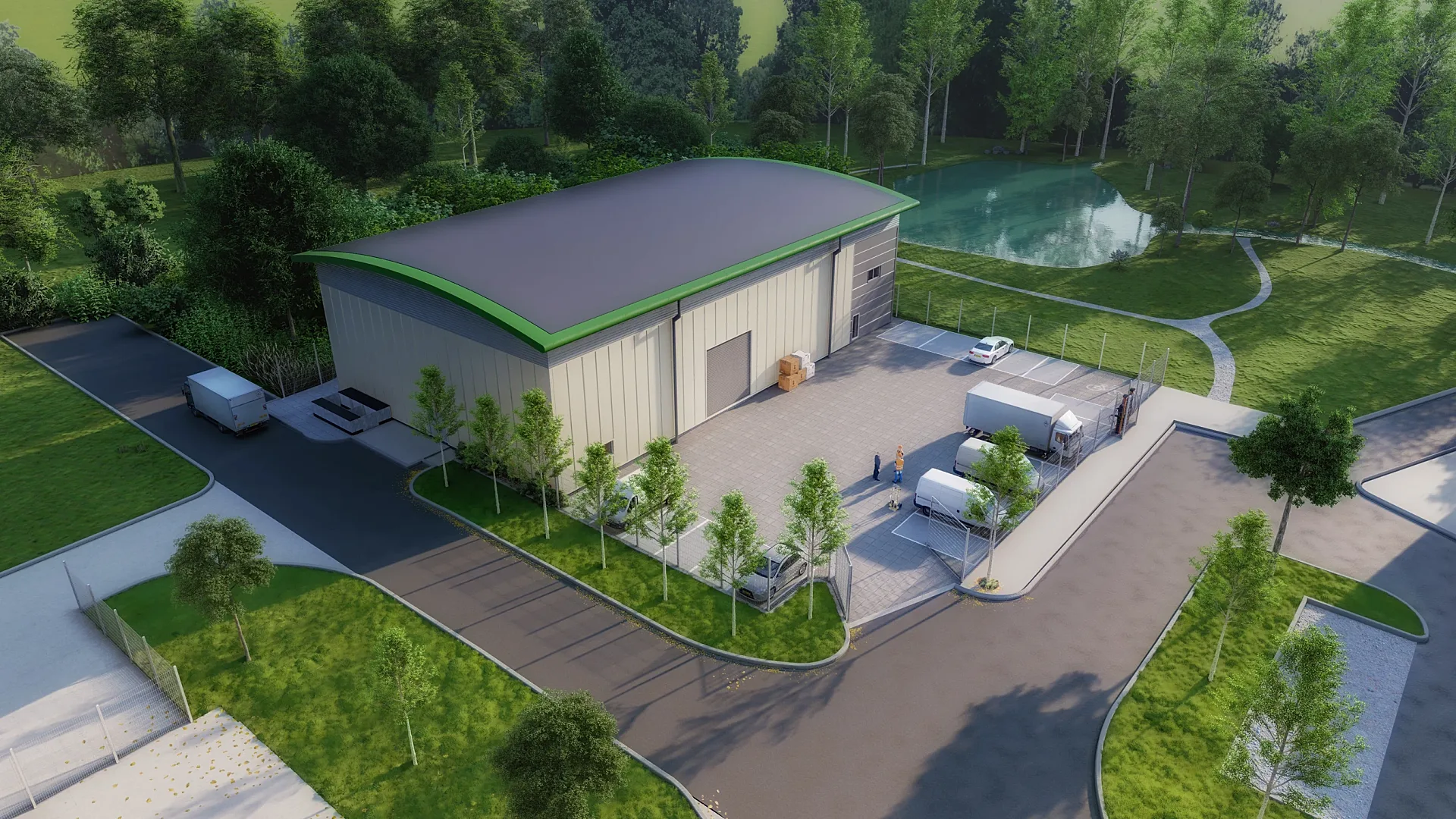 Industrial Warehouse with Site Aerial
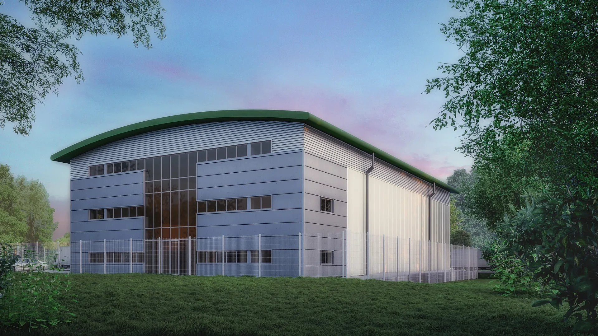 Industrial Warehouse with Site Aerial
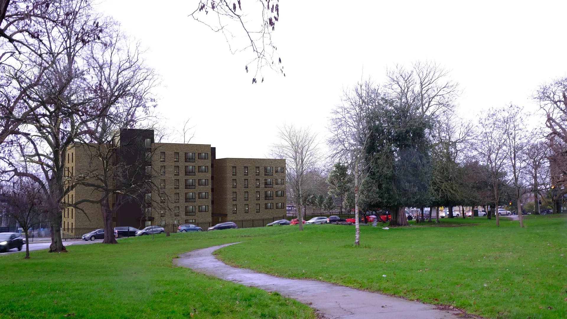 Pre-Lodgement Street Views and Aerial
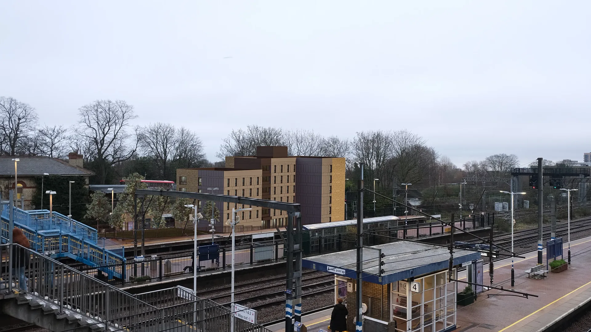 Pre-Lodgement Street Views and Aerial
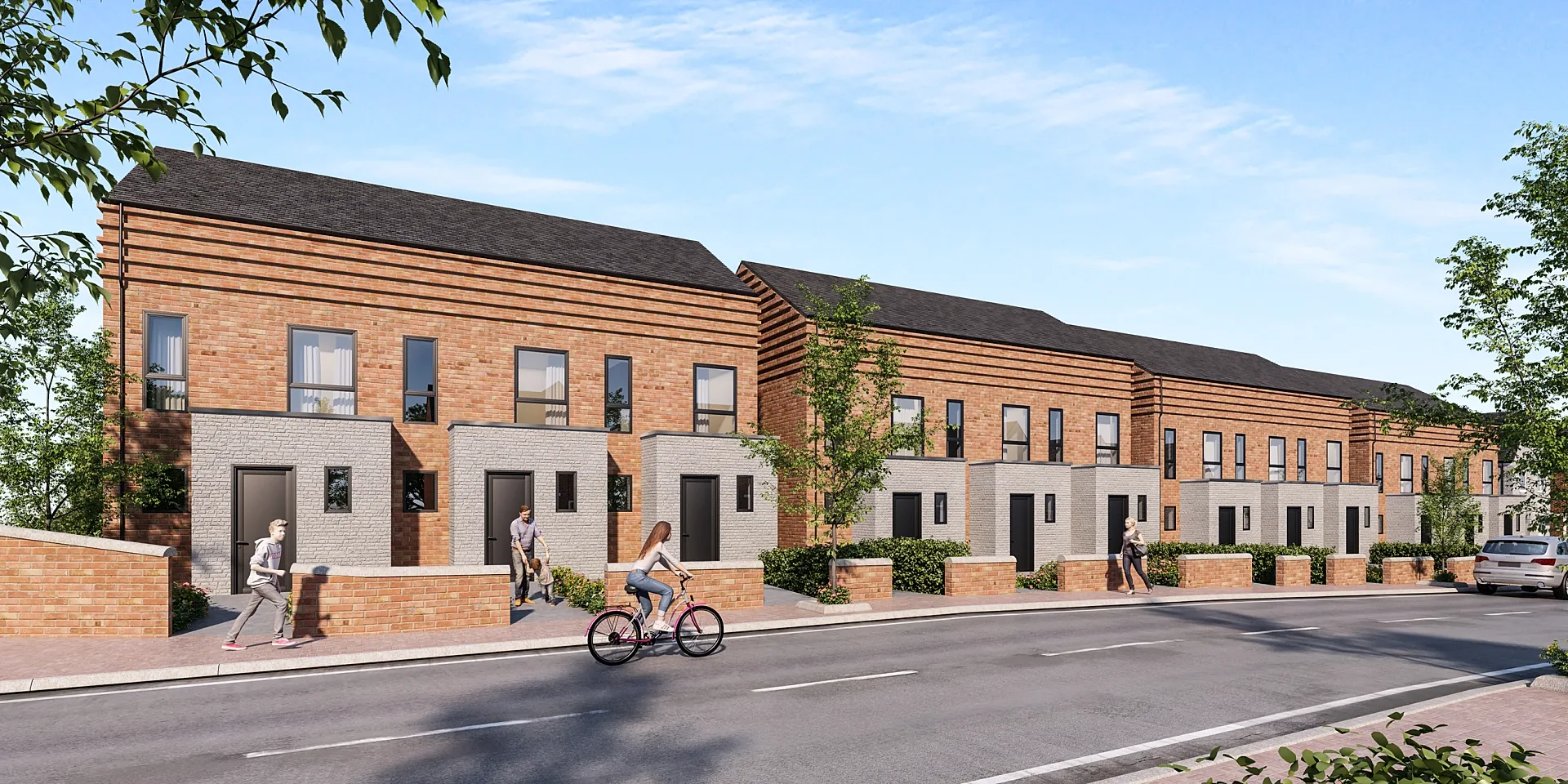 Terraced Townhouse Launch Set
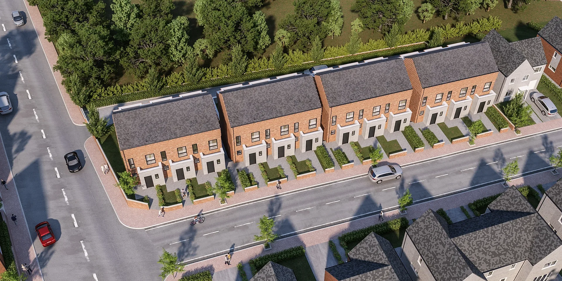 Terraced Townhouse Launch Set
Estate and land-release masterplan renders
An estate masterplan render has to do two jobs at once. For a buyer it shows where the park is, how far the lot is from the entry and which way the street runs. For a funder, an agent or a council officer it shows that the layout is coherent. We build it from the approved subdivision layout, with road widths, kerb lines, verges, drainage reserves and open space taken from your plans, then add trees and landscaping at the size the landscape plan specifies.
A staged release suits a set of aerials rather than a single one. Each stage can be shown on its own, with the remaining stages greyed or lightly shown as future land, so one model supports the stage one launch and the stage three launch without re-drawing the estate. Lot plans follow the same logic. A lot overlay lifts the lots off the page for sale, and an availability board can be re-issued as lots sell.
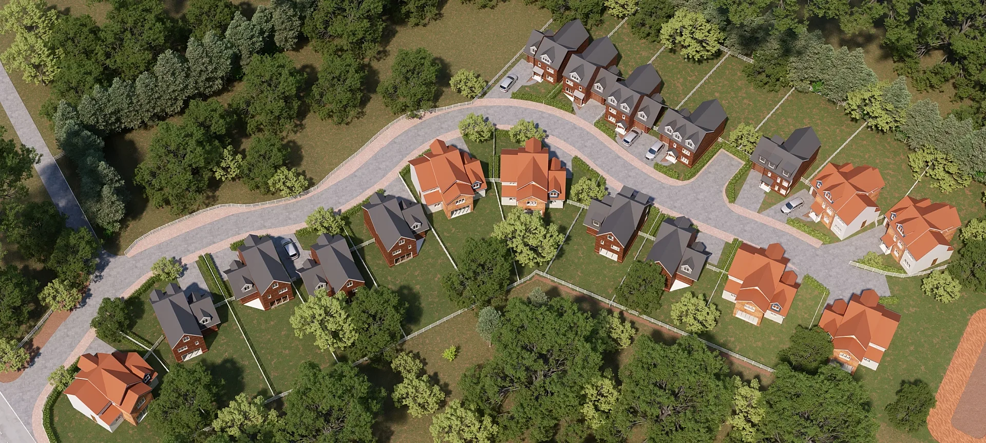
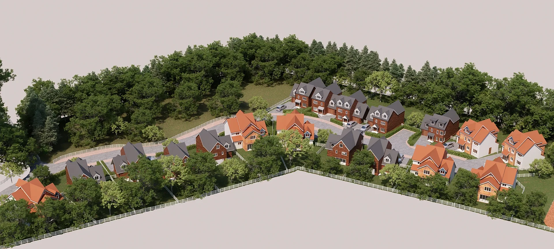
Our Detached Homes Estate project shows the range: an aerial of the whole development, a bird's-eye 3D site plan of all eighteen lots built from the approved layout, and show-home interiors for the brochure and online listings. It is a useful reference for house-and-land packages, where the buyer first needs the lot and then the house.
Townhouse communities, industrial estates and mixed-use precincts
Different schemes want different aerials, so the camera and the level of detail change with the project.
Townhouse communities
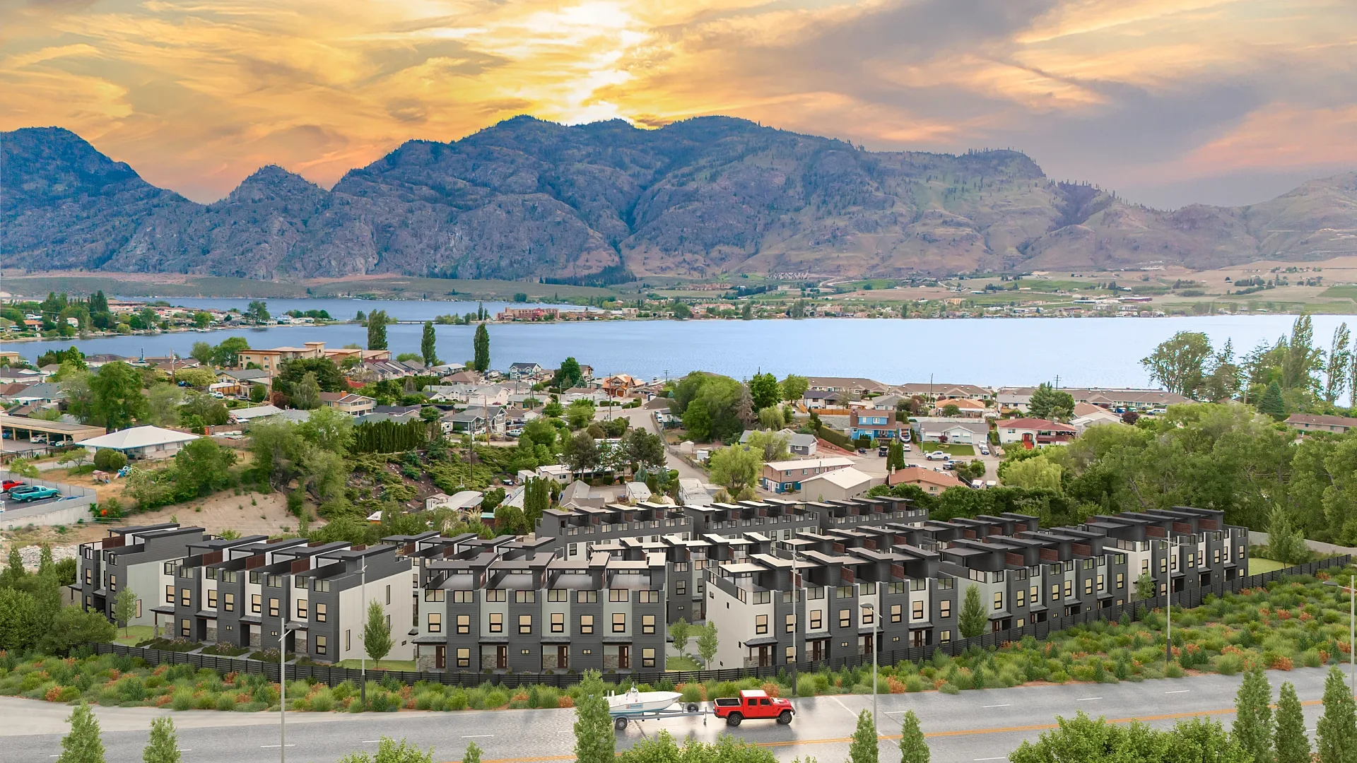
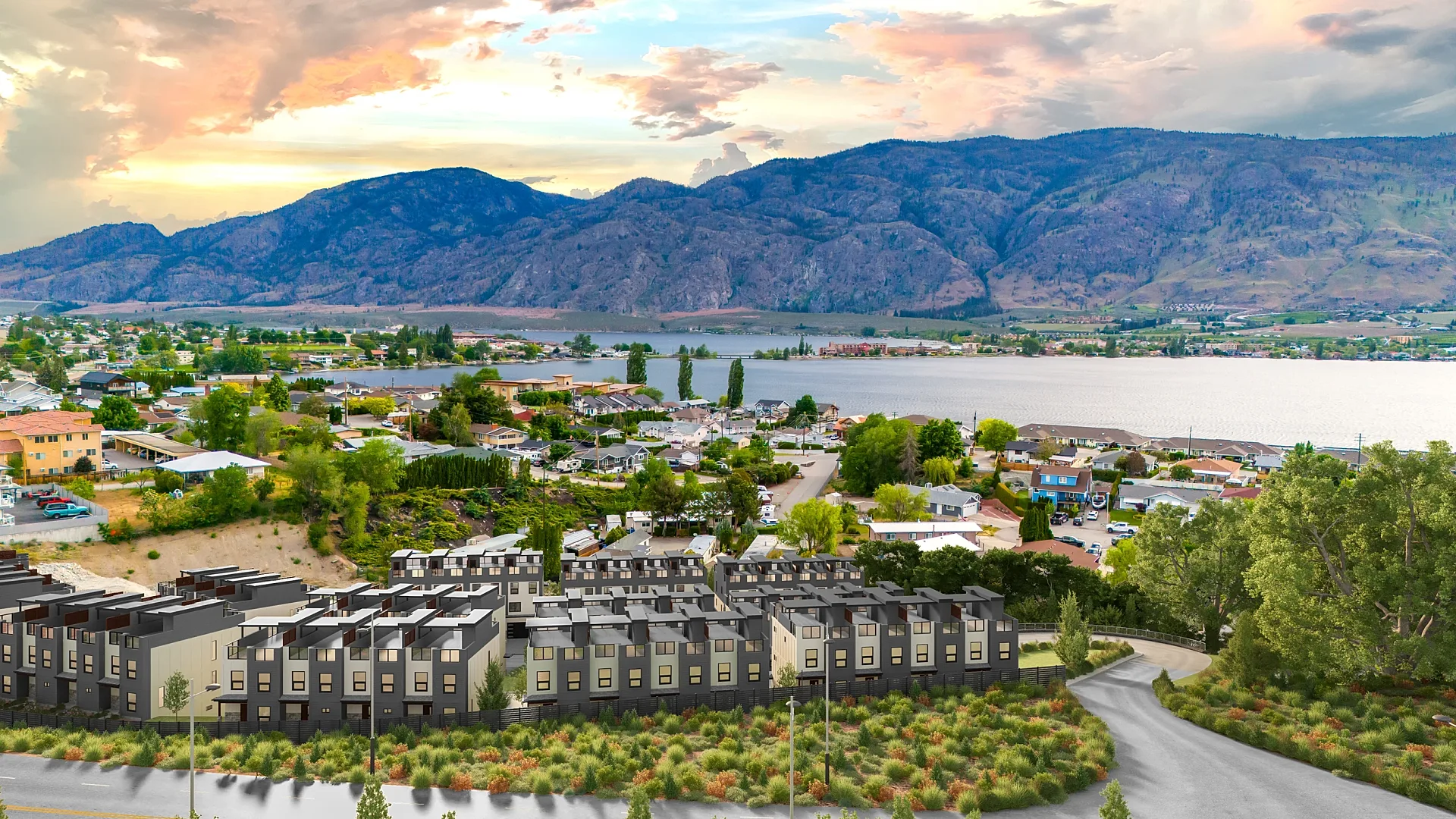
A townhouse development is a repeated form, so the aerial has to show the repetition working. From above, the rows have to read as a deliberate rhythm, with the shared pool, the internal road and the visitor parking placed where the site plan puts them. Our Hillside Townhouse Community project was a staged launch with dusk aerials that place the rows against the surrounding streets, hills and lake, a rendered site plan used for lot selection and a rooftop-deck view. See our page on townhouse and duplex rendering for the street-level and interior work.
Industrial estates and logistics parks
For a warehouse or a logistics park the aerial is a working document. Tenants, staff and approvers want to see truck circulation, the loading yard, the car park, the access road, what stays as retained vegetation and where services run. Our Industrial Warehouse with Site Aerial project shows an oblique view of a new building and its yard, including the revised tree removals for a cable route, made for a staff presentation. Trucks and cars are placed for scale, and the retained trees are shown as drawn. Our commercial visualisation page covers the buildings themselves.
Mixed-use precincts
A precinct aerial has to separate the layers: what is new, what exists and what is planned. We model the new buildings in full, set existing neighbours as simplified massing, and show future stages as flat or ghosted blocks, so the picture is clear about what is being proposed now. Labels for streets, the main public spaces and the staging order do much of the explaining.
Model-only aerials or drone-photo aerials
There are two ways to ground an aerial, and the choice should be made early because it decides what you need to send.
A model-only aerial builds the surroundings in 3D from mapping imagery, survey and your drawings. It is flexible, because any angle, time of day or season can be produced, and it needs no field work. Its limit is that the context is only as accurate as the data behind it, so adjoining roofs and trees are drawn from imagery and are simplified.
A drone-photo aerial places the proposal into a photograph taken from the air, so the neighbouring streets, the vegetation, the coastline or the hills are real. The Hillside Townhouse Community aerials work this way, composited over licensed drone photographs so the scheme sits accurately on its site. The photograph fixes the view, so the angle is the one the operator flew. The drone footage comes from you or from a local operator we arrange, and we ask for the aircraft's position, height and camera settings so the model camera can be matched to the frame.
Where the aerial is the base for a planning view, the method is the same as for an architectural photomontage, and the camera data matters in the same way. Tell us if the image is going to council.
How much of the surroundings we model
The edge of the model is a decision, not an accident. Too tight and the scheme floats in a void. Too wide and the budget goes into streets nobody is looking at. We set the extent from the camera: everything visible from the chosen angles is modelled to a level of detail that falls away with distance.
In practice that means three zones. The site itself is built in full from your drawings. A surrounding ring, typically the adjoining lots, roads and the nearest buildings, is modelled from survey and imagery so its height and bulk are honest. Beyond that, the distant context is imagery, simple massing or a photographic backdrop. Tell us which neighbours matter, such as a school, a park, a rail line or a creek, and we put the detail where the viewer will look.
Mapping imagery is a good starting point and a poor finish. Our Pre-Lodgement Street Views and Aerial project used it to build a high-level context view when no site photograph existed, which worked because it was one view in a larger set of camera-matched photomontages. For a sales aerial we ask for survey or a drone photograph where the surroundings carry weight.
Labels, lot overlays and sales plans
An aerial sells more when it explains itself. We add the labels the buyer needs and keep them off the parts of the image that matter.
- Lot numbers and boundaries, with lot sizes if you supply them.
- Stage lines, with each release in its own tint.
- Street names, entries and key destinations such as the park, school or station.
- Landmarks and walking distances drawn as simple lines.
- Availability colours that can be re-issued as lots sell.
- A key and a north point, set in your brand colours and fonts.
Street-level views and flyovers from the same model
The model that makes the aerial can make everything else for the project. A streetscape at the entry, a view down a typical street, the park and the pool are cut from the same file, so the pictures agree with each other and with the plan. Our 3D exterior renders cover those street-level views, and an aerial and a street view can be commissioned as a pair so a buyer can find the lot and then picture the house.
Where a moving picture is wanted, the same model is the base for a flyover. Our 3D architectural animation page covers how a flyover is built, how it is priced and what the storyboard stage involves. A flyover also needs the context to hold up from lower angles, which is worth deciding before the aerial is built.
What aerial renders cost and what to send
Aerial and masterplan views start from A$795 per image. Animation starts from A$65 per second with a 30-second minimum. Sets of five images or more are priced as a package, which suits a staged release. Scope moves the price: the size of the site, the number of stages, how many lots are labelled, the extent of surroundings and whether a drone photograph or a model-only base is used. Our 3D rendering cost guide sets out what moves it in general.
To start, send the site plan or subdivision layout (DWG or PDF), the survey if you have it, the architectural drawings for the buildings, the landscape plan and any lot schedule you want labelled. If a drone photograph is wanted, tell us before it is flown. We send a draft render with materials and lighting close to final, and revisions come from your mark-ups, with up to 4 rounds included. Rush delivery of 48–72 hours (rush surcharge applies) is available.
Proof
3D Aerial Rendering projects from the portfolio
Aerial & masterplan
Hillside Townhouse Community
Aerial & masterplan
Detached Homes Estate: Aerial and Display Home Interiors
Commercial
Industrial Warehouse with Site Aerial
Planning & photomontage
Pre-Lodgement Street Views and Aerial
Multi-residential
Terraced Townhouse Launch Set
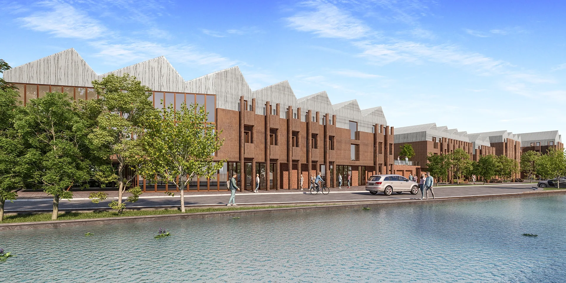
Multi-residential
Waterfront Student Accommodation
How it works
How we produce 3D aerial rendering
- 01
Send your drawings
Plans, elevations and sections in PDF, DWG, SketchUp, Revit or ArchiCAD — or a marked-up sketch. Add material schedules, finishes and any reference photos you like.
- 02
Fixed quote in one business day
You get a per-image price in AUD, the delivery date and what's included. No hourly billing and no surprises at invoice time.
- 03
Draft render for your feedback
Within 3–4 days you receive a draft render with materials and lighting close to what you need — the angles, finishes and mood all visible — so feedback is about real images, not diagrams.
- 04
Revisions from your mark-ups
You mark up the draft and we work through the changes. Up to 4 revision rounds are included.
- 05
Final delivery
High-resolution files (4K–8K TIFF/JPEG/PNG) sized for print and web, typically in 5–7 business days from brief. Rush delivery available in 48–72 hours (rush surcharge applies).
Questions
3D Aerial Rendering: frequently asked questions
Aerial and masterplan views start from A$795 per image. Sets of five or more are priced as a package. Site size, stages, labelling and the extent of surroundings change the price. Send the site plan for a fixed quote.
A model-only aerial builds the surroundings in 3D, so any angle or time of day is possible. A drone-photo aerial composites the proposal into a photograph taken from the air, so the neighbouring streets and landscape are real. The drone photo fixes the view to the angle flown.
No. We work remotely from drawings. Drone footage comes from you or from a local operator we arrange. Tell us before the flight and we say which camera settings, height and position to record so the model can be matched.
Yes. We add lot numbers, boundaries, stage tints, street names and key destinations, and can re-issue the image with availability colours as lots sell. Send the lot schedule and we place the labels.
As far as the camera sees, with detail falling away with distance. The site is built in full, the adjoining lots and roads from survey and imagery, and the distant context as massing or a photographic backdrop. Tell us which neighbours matter most.
Yes. The aerial, the street views and the interiors all come from one model, so they agree with each other. Later views cost less than the first, and a flyover animation can be cut from the same file.
It can illustrate the proposal. A view that has to be checked, such as a drone photograph matched to a surveyed camera, follows the photomontage method. Ask the council what the application needs and tell us which images go in.
Where we work
3D Aerial Rendering across Australia
Same published prices in every city, with local planning context and building products.
3D Aerial Rendering is one part of our architectural visualisation work, which also covers planning renders and verified views for councils and tribunals.
- Melbourne projects
- Sydney projects
New South Wales
3D rendering Sydney
Parramatta, Green Square, Zetland, Rhodes, Macquarie Park and across NSW.
- Brisbane projects
Queensland
3D rendering Brisbane
Newstead, Fortitude Valley, South Brisbane, West End, Woolloongabba and across QLD.
- Perth projects
Western Australia
3D rendering Perth
Subiaco, Leederville, Scarborough, Joondalup, Ellenbrook and across WA.
- Adelaide projects
South Australia
3D rendering Adelaide
Adelaide CBD, North Adelaide, Glenelg, Henley Beach, Semaphore and across SA.
Related services
Often ordered with this service
3D Exterior Rendering
3D exterior rendering and facade visuals for Australian developers, builders and architects.
from A$445
3D Architectural Animation
3D architectural animation, walkthroughs and flythroughs for Australian developers and architects.
from A$65
Architectural Photomontage
Architectural photomontage and verified views for DAs, objections and lot sales, built into your site photographs.
from A$445
Townhouse & Duplex Rendering
Townhouse and duplex 3D rendering: streetscapes, dwelling types and interiors for launches and planning, from A$445 per image.
from A$445
Commercial 3D Rendering
Commercial 3D rendering for retail, office, hospitality and industrial projects across Australia.
from A$445
Get a fixed AUD quote within one business day
Send us your plans, elevations or even a sketch. Exterior renders from A$445, interiors from A$345, delivered in 5–7 business days.